By Sarah Hammonds, Urban Greening Senior Officer This blog discusses the launch of two new tools: the Index of Multiple Environmental Deprivation (IMED) and the Environmental Equity Index (EEI). Built collaboratively over 18 months, they map environmental pressures and health …
By Martin Moss, Senior Officer - Green Infrastructure Mapping Team As recognition grows of the importance of nature to our health and wellbeing, understanding green infrastructure provision is vital to ensuring everyone can benefit from nature wherever they live. Natural …
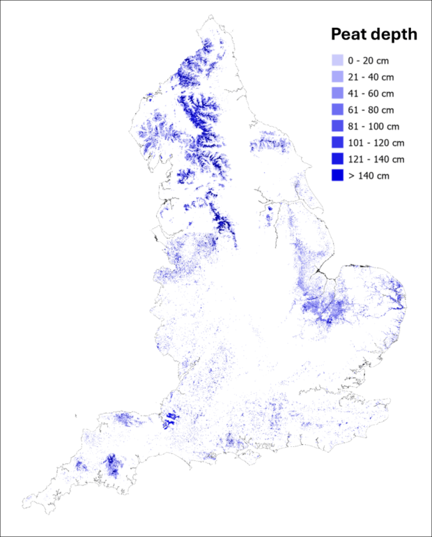
We’re in the middle of a step change for national-scale environmental evidence in England. In recent years, the Natural Capital and Ecosystem Assessment (NCEA) programme has allowed us to create and upgrade maps and data products like the England Peat …
By David Drake, Director for People and Nature, Natural England On 24 April 2025, I had the privilege of joining a remarkable celebration - the 60th anniversary of the Pennine Way. As Britain’s first National Trail, the Pennine Way remains …
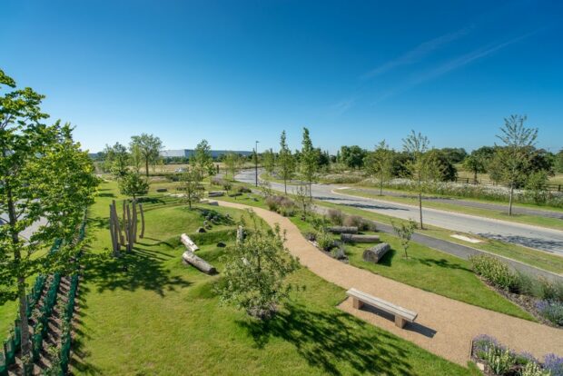
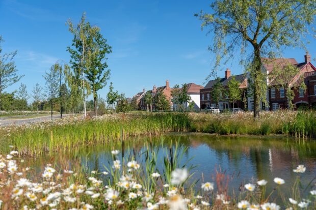
In Britain's increasingly urban landscape, where 85% of the population lives in towns and cities, green infrastructure has become essential for collective wellbeing. Yet one-third of people cannot access quality natural spaces within 15 minutes of home - a deficit …
By Dr Ruth Waters, Director for Evidence, Natural England, and David Jones, Senior Responsible Officer for the Natural Capital and Ecosystem Assessment, Defra England’s peat deposits are one of our most valuable national assets. They’re our largest carbon store, they …
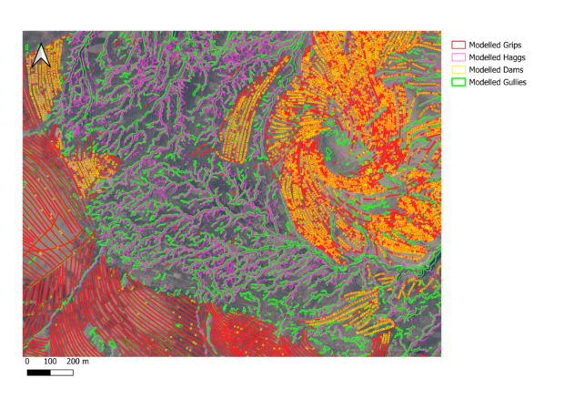
AI4Peat Project team members: Anne Williams, Michelle Johnson, Samuel Richardson, Nick Tomline, Martha Tabor, Phil Shea. Restoring Peatlands Peatlands are among the UK's most valuable ecosystems, playing a crucial role in carbon storage, water regulation, and biodiversity. However, many peatland …
By Gabriella Fasoli and Nick Tomline (AI specialists), Emma Milner (marine mammal specialist) and Elizabeth Mitchell (engagement), all on the marine Natural Capital and Ecosystem Assessment (mNCEA) programme Documenting Norfolk's biggest beach party On a windy day in December, something …
It’s two years since Natural England launched the Green Infrastructure (GI) Framework to support the creation of good quality Green Infrastructure. It’s well documented that we need to build a more sustainable future, and at the forefront of this movement …
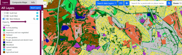
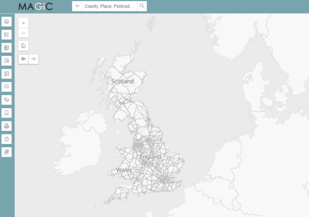
What is MAGIC? The ‘Multi-Agency Geographic Information for the Countryside’ (MAGIC) service has been around since 2002. The MAGIC website provides geographic information about the natural environment from across government. The information covers rural, urban, coastal and marine environments across …
Related content and links
Stories and updates from Natural England
We’re the government’s adviser for the natural environment, helping to protect England’s nature and landscapes for people to enjoy.


Recent Comments